Cloud types
Most clouds are associated with weather. These clouds can be divided into groups mainly based on the height of the cloud's base above the Earth's surface. The following provides information about cloud groups and any cloud classes associated with them. In addition, some clouds don't fall into the categories by height. These additional cloud groups are listed below the high, middle, and low cloud groups.
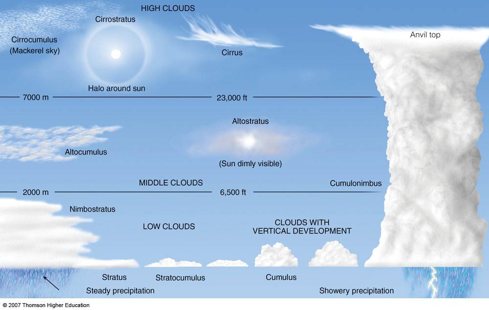
High Clouds 6,000 - 20,000 m
The cloud heights provided here are for the mid-latitudes. Cloud heights are different at the tropics and in the polar region. In addition, a few other cloud types are found in higher layers of the atmosphere. Polar stratospheric clouds are located in a layer of the atmosphere called the stratosphere. Polar mesoshperic, or noctilucent, clouds are located in the atmospheric layer called the mesosphere. Noctilucent clouds are the highest clouds in the sky, however they are not associated with weather like the rest of the clouds provided here.
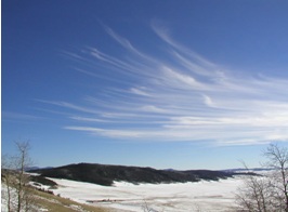
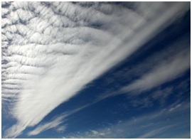
Cirrus
Cirrus clouds are the most common of the High Cloud (5000-13000m) group. They are composed entirely of ice and consist of long, thin, wispy streamers. They are commonly known as "mare's tails" because of their appearance. Cirrus clouds are usually white and predict fair weather.
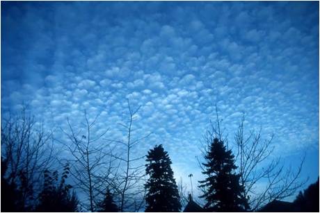
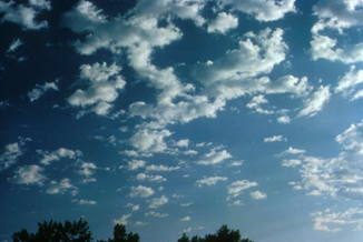
Cirrocumulus
They are small rounded puffs that usually appear in long rows. Cirrocumulus clouds are usually white, but sometimes appear gray. Cirrocumulus clouds are the same size or smaller than the width of your littlest finger when you hold up your had at arm's length. If these clouds cover a lot of the sky, it is called a "mackerel sky" because the sky looks like the scales of a fish. Cirrocumulus clouds are usually seen in the winter time and indicate fair, but cold weather.
Cirrostratus
Cirrostratus clouds belong to the High Cloud (5000-13000m) group. They are sheetlike thin clouds that usually cover the entire sky.The sun or moon can shine through cirrostratus clouds . Sometimes, the sun or moon will appear to have a halo around it when in the presence of cirrostratus. The ice crystals from the cloud refracts the light from the sun or moon, creating a halo. This halo is the width of your hand when you hold it out at arm's length.Cirrostratus clouds usually come 12-24 hours before a rain or snow storm. This is especially true if Middle group clouds are associated with it.
Middle Clouds 2,000 - 6,000m
The middle cloud group consists of Altostratus and Altocumulus clouds. Middle clouds are made of ice crystals and water droplets. The base of a middle cloud above the surface can be anywhere from 2000-8000m in the tropics to 2000-4000m in the polar regions.
Altocumulus
Altocumulus clouds are part of the Middle Cloud group (2000-7000m up). They are grayish-white with one part of the cloud darker than the other. Altocumulus clouds usually form in groups and are about 1 km thick.Altocumulus clouds are about as wide as your thumb when you hold up your hand at arm's length to look at the cloud. If you see altocumulus clouds on a warm humid morning, then expect thunderstorms by late afternoon.
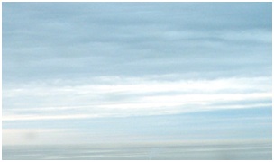
Altostratus
Altostratus belong to the Middle Cloud group (2000-7000m up). An altostratus cloud usually covers the whole sky and has a gray or blue-gray appearance. The sun or moon may shine through an altostratus cloud, but will appear watery or fuzzy.
Low clouds 0 - 2000 m
The low cloud group consists of Stratus, Stratocumulus, and Nimbostratus clouds. Low clouds consist of water droplets. The base of a low cloud is from the ground surface to 2000 m.
Stratus
Stratus clouds belong to the Low Cloud (surface-2000m up) group. They are uniform gray in color and can cover most or all of the sky. Stratus clouds can look like a fog that doesn't reach the ground. Light mist or drizzle is sometimes associated with stratus clouds.
Stratocumulus
Stratocumulus clouds belong to the Low Cloud (surface-2000m) group. These clouds are low, lumpy, and gray. These clouds can look like cells under a microscope - sometimes they line up in rows and other times they spread out. Only light precipitation, generally in the form of drizzle, occurs with stratocumulus clouds. To distinguish between a stratocumulus and an altocumulus cloud, point your hand toward the cloud. If the cloud is about the size of your fist, then it is stratocumulus.
Nimbostratus
Nimbostratusclouds belong to the Low Cloud (surface to 2000m up) group. They are dark gray with a ragged base. Nimbostratus clouds are associated with continuous rain or snow. Sometimes they cover the whole sky and you can't see the edges of the cloud.
Cloud formation
Clouds are generally produced by atmospheric motions with an upward component that cool the air; in some cases, particularly in the upper atmosphere and polar regions, radiative cooling can also cause clouds to form.
In general, clouds tend to form in one of three ways:
1. Clouds may form when the air mass is cooled below its dewpoint. This may happen when the air rises or comes into contact with a cold surface. This can happen where cold and warm air masses collide, and the warmer air (with less density) is lifted to greater altitude. It can also happen where air masses are flowing across a mountain range and are lifted for orographic reasons, or it may be caused by convection due to warming of the terrain surface below.
2. Clouds may form when warm air blows over a colder surface such as a surface of water with low temperature.
3. Clouds can be formed at places where the air temperature increases slowly or remains unchanged, but the air mass rapidly absorbs water vapour from a surface below until it reaches the dew point. This often happens where cold and dry air masses flow across a warm ocean surface without ice cover.
The actual form of cloud created depends on local conditions like the strength of the uplift and the air stability. In unstable conditions convection dominates, creating vertically developed clouds. Stable air produces horizontally homogeneous clouds. Frontal uplift along colliding warm and cold creates various cloud forms depending on the composition of the front (warm or cold front). Orographic uplift across mountain ranges also creates variable cloud forms depending on air stability, although cloud types like cap cloud and wave clouds are specific to such orographic clouds.